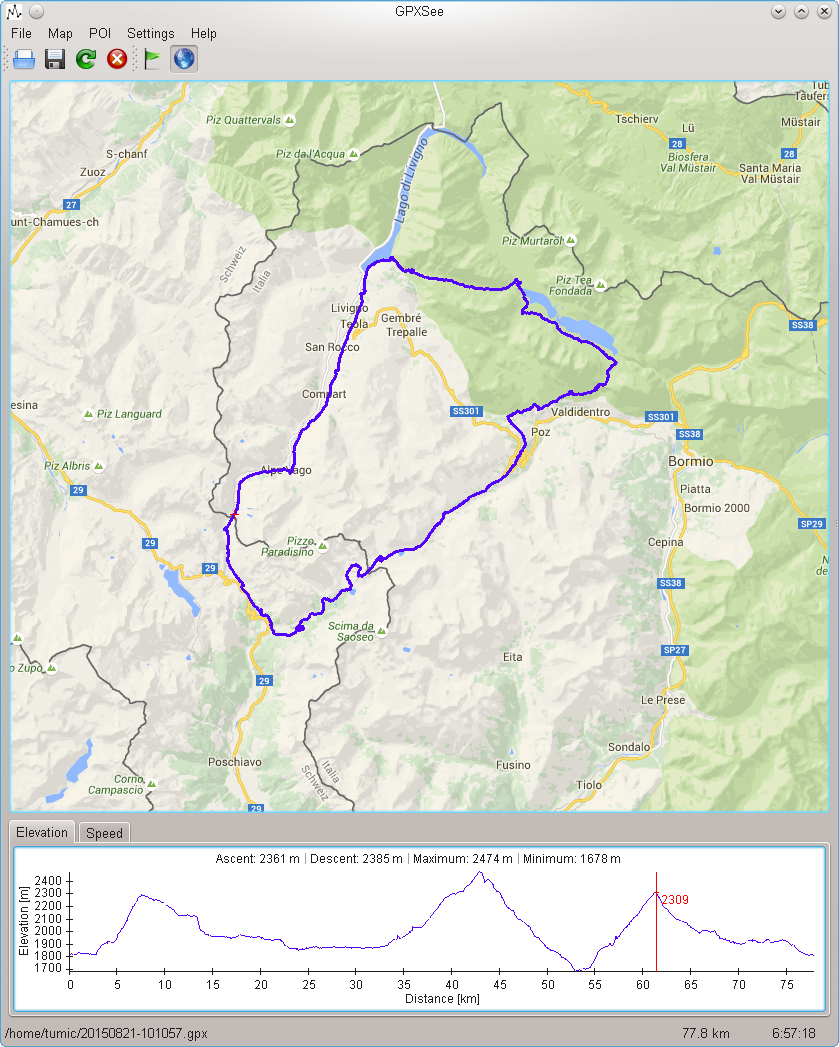
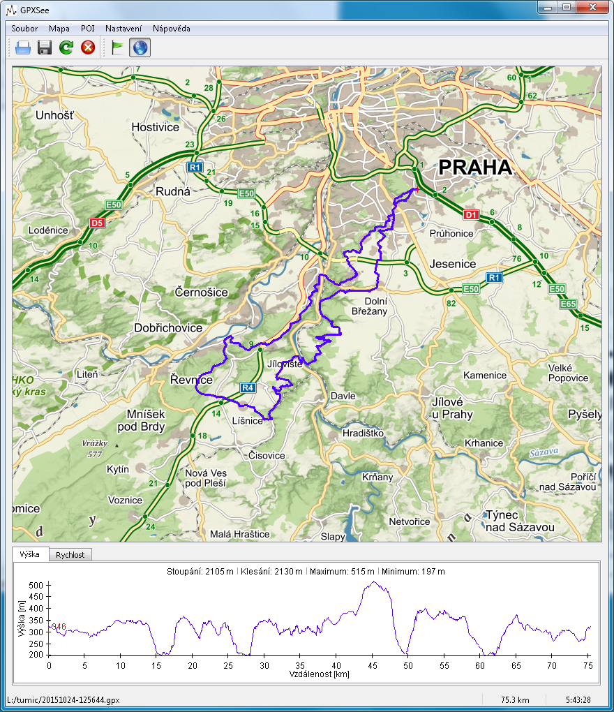
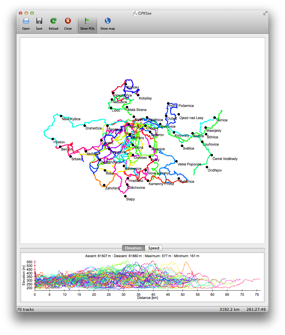
Description: GPXSee is a Qt based tool for visualizing and analyzing GPX files.
Key features: - User-definable map sources. - Track and elevation/speed graphs. - Support for multiple tracks in one view. - Support for POI files (Garmin CSV format). - Export to PDF. - Native GUI for Windows, Mac OS X and Linux.
Hi, you have done a great job and it seems to be very nice and user friendly app.
One problem i faced is that i could not configured the app as required and hence i get no map no poi and no graphs :(
Can you please place working demo files alongwith source files?
Thanks
Hi,
Well, there are no map sources definitions included because I don't have the time to read all the usage policies and find out whether I can add them to the app or not. Following are two real examples, but as already said, it's upon you to find out, if using the tiles is OK /in your country)
Google http://mts1.google.com/vt/x=$x&y=$y&z=$z
Thunderforest http://tile.thunderforest.com/outdoors/$z/$x/$y.png
You can find the exact path, where to put the maps.txt file (with the content above) on your system in the "Help->Data sources" menu in GPXSee. Note, that the map name and URL is delimited by a TAB character.
P.S.: My user account under which I posted the app here somehow became "inactive", that's why I'm writing from another one.
Thanks a lot! I got it working now :)
Here i tell you what i did:
First of all i download a sample ".gpx" file from internet:
I downloaded "sebenches.gpx" from "http://www.saltlakecycling.com/rides/saltlakerides/sebenches.gpx"
===> Before Running GPXSee <===
=> Created a folder "GPXSee" in "C:\Users\USER_NAME"
=> Opened above "GPXSee" folder
=> Created "maps.txt" file inside above "GPXSee" folder and placed following line in it with "MAP1" and "URL" delimited by a TAB character:
Map1 http://a.tile.openstreetmap.org/$z/$x/$y.png
===> Now Started GPXSee <===
=>Clicked on "File" menu
=>Clicked "Open" in "File" menu to load "sebenches.gpx'
Ahaa i got NiCe track!!! :)
But no map :( Wait i tell you how i got map shown! :)
=>In the toolbar I clicked on "Earth icon" and waited for a while and lo i got map shown!
====> Mission Accomplished <====
Thanks for the nice app and source code too!


Ratings & Comments
4 Comments
Can i use offline map in this app?
Hi, you have done a great job and it seems to be very nice and user friendly app. One problem i faced is that i could not configured the app as required and hence i get no map no poi and no graphs :( Can you please place working demo files alongwith source files? Thanks
Hi, Well, there are no map sources definitions included because I don't have the time to read all the usage policies and find out whether I can add them to the app or not. Following are two real examples, but as already said, it's upon you to find out, if using the tiles is OK /in your country) Google http://mts1.google.com/vt/x=$x&y=$y&z=$z Thunderforest http://tile.thunderforest.com/outdoors/$z/$x/$y.png You can find the exact path, where to put the maps.txt file (with the content above) on your system in the "Help->Data sources" menu in GPXSee. Note, that the map name and URL is delimited by a TAB character. P.S.: My user account under which I posted the app here somehow became "inactive", that's why I'm writing from another one.
Thanks a lot! I got it working now :) Here i tell you what i did: First of all i download a sample ".gpx" file from internet: I downloaded "sebenches.gpx" from "http://www.saltlakecycling.com/rides/saltlakerides/sebenches.gpx" ===> Before Running GPXSee <=== => Created a folder "GPXSee" in "C:\Users\USER_NAME" => Opened above "GPXSee" folder => Created "maps.txt" file inside above "GPXSee" folder and placed following line in it with "MAP1" and "URL" delimited by a TAB character: Map1 http://a.tile.openstreetmap.org/$z/$x/$y.png ===> Now Started GPXSee <=== =>Clicked on "File" menu =>Clicked "Open" in "File" menu to load "sebenches.gpx' Ahaa i got NiCe track!!! :) But no map :( Wait i tell you how i got map shown! :) =>In the toolbar I clicked on "Earth icon" and waited for a while and lo i got map shown! ====> Mission Accomplished <==== Thanks for the nice app and source code too!